Archive
Mapping Across Borders Website Open!
The Mapping Across Borders website is up and running and we are pretty excited to welcome all blog readers to have a look at it;
The Mapping Across Borders website currently allows visitors a chance to get to know the organization through videos, text, a concept note and an interactive map on the homepage. You can also register from a link on the front page which will allow you to stay in touch with Mapping Across Borders via a mailing list. This way, when Mapping Across Borders is ready to open more services for users, you will be the first to know!
Currently there is still a lot more of the Mapping Across Border’s website to come, but we are steadily working away on it here at UBC Okanagan. This morning we were weeding into database designs and figuring out all of the ways that we want to create intuitive and engaging user interfaces. We hope to have more really cool things to show everyone by September!
Google Earth Engine
![]()
Google has just recently developed a tool that is kind of a big deal for anyone who does research using remote sensing (images from satellites). They have decided that they are going to open up a massive database of imagery that is both up to date and historical (reaching back twenty five years, apparently) for any researcher or scientist working on environmental issues. Science and Development, an online news agency said this of the program
A satellite imagery tool that will make an unprecedented amount of environmental data available freely online has been launched at the UN Climate Change Conference (COP 16), in Mexico. Earth Engine, launched by Google on 3 December, aims to enable scientists to monitor and measure changes in the Earth’s environment, such as global land cover, and hopefully help slow deforestation in the process.
Commentary and a look at it inside…
Catching up!
It has been some time since the last update on this blog and so much has happened since the last update. I’ll try to update you since the last time I wrote, hopefully with brevity in mind. I’ve been working on how to get local NGOs in East Africa up to speed using GIS. This technology hasn’t really taken off in a big way just yet in that part of the world, but can be a seriously helpful in planning, monitoring and evaluating rural development projects.
Ethiopian Portrait Series – Wubishet, Engineer
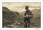
The photo presented today is the third installment of the portrait series. Featured in this photograph is Wubishet, an Engineer working at the NGO where I am interning (click thumbnail for larger version).
Ethiopian Portrait Series – Sendafa Spring Water CBI
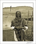
Today the portrait series continues with a Gentleman that I met in Sendafa, Ethiopia. Sendafa is about forty five minutes outside of Addis, and is the closest program office. Accordingly I have been there three times and met with their program staff in Addis as well.
On my first trip to Sendafa, I saw a number of initiatives. The one that I was most impressed with, from a community development point of view, was a spring fed water resource that the local community had come together to manage and facilitate. Read more…
Ethiopian Portrait Series
Much has happened since my last post, I’ve gone on a few more trips and given three training sessions on GIS. Life is busy, but it wouldn’t nearly be as fun if it wasn’t.
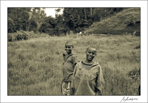
I’ve met a number of really interesting people along the way. I’ve been taken in by their stories and now had some time to reflect on them. In the next few blogs, I’m going to attempt to tell these stories and share the portraits I took.
First Up, Hosanna
Maps (3 of 3)


ASE Amaro Small Scale Irrigation project & Zonal Boundaries Maps
The final map that I made for AgriService was a visualization of the diversion weirs that ASE was constructing (see this post for more information). Wubishet, while planning the projects had used a large piece of onionskin to trace over top of older basemaps where the catchment areas, diversion weirs, canals and irrigated lands would be. While this was adequate for his planning, the onionskin map is not easily reproducible and was not able to stand alone, without the basemap behind it. My job here would be to reproduce the features on the onionskin and update the look of the map to presentation quality. Read more…
Maps (2 of 3)

Tsetse Fly Hotspot Mapping
When I was finished with the Kereda Reservoir Map, I decided to set my sights on the Tsetse fly mapping. The data that I would need was with the ICIPE, so I needed to visit them before I could complete the maps (actually, I needed to get some of the data for the Reservoir project too). I set a meeting with the ICIPE (African Insect Science for Food and Health, http://www.icipe.org) , and within a few days I was off to their office on the east side of Addis. Read more…
Maps! (1 of 3)

After the Amaro Field trip, I had an awful lot of work to do. I felt a bit like having a number of projects to do at once and then once massive term project on top of it. The next three post will go through the resulting maps, how I made them and the hurdles I faced along the way. Read more…
Amaro and the South of Ethiopia (2 of 2)

Sunrise over the Gelana Valley
On Wednesday I woke up at 6:30am ready to get on the road and begin another day in the field. I joined Wubishet, Solomon and Dr. Shiffa at the Landcruiser and we set off northwards towards Burji, a neighbouring woreda. Our mandate that morning was to visit the woreda office in Burji so that Solomon and Shiffa could get some information for a proposal they were working on (to expand the Tsestse trap program we had looked at the previous day) and also to visit an irrigation project ASE was establishing in the area. Read more…


