Ethiopia: Week Three – Participatory Mapping on-the-fly
After a jam packed week of mapping for in Addis and the northern areas of Ethiopia, I made my way back to Addis Ababa to pick up a new Mapping Across Borders field staff member, Joshua Palmer.
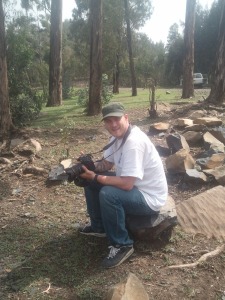
Josh joined Mapping Across Borders in January, 2011 as a University of British Columbia work-studies student, putting his efforts into getting the Mapping Across Borders Website up and running. Through his work, the MAB wiki and leaning space started taking shape. So, when it came time to find someone who could join me overseas to help with MAB activities, Josh was the obvious candidate. Having Josh see development from an on-the-ground perspective would let him understand not only where his time and effort was going, but also to get an appreciation of what mapping for development means.
During this trip I specifically tasked Josh with three main activities;
1) Capture photos and videos of Mapping Across Borders activities
2) Help with data processing and cartography
3) Act as a teaching assistant during Open Source GIS training activities
Welcome to Addis, Josh!
With the goals for his time and the specific tasks that I knew he could accomplish in mind, I eagerly left the apartment I was renting for the airport on the Sunday night before my third week in Ethiopia. His flight was due to arrive at 12:30am so I left around 12:25am and bargained with a taxi driver to drive me to the airport, wait for me to collect josh, and then drive us back to the apartment. He agreed to a reasonable price and we set off. Once at the airport, I took the driver’s cell number and headed into the airport.
Airport procedures in Canada and Ethiopia are a little different. To be able to wait for josh in the arrivals hall, I first needed to buy an airport entry ticket and submit to security screening. Once I was through the screening everything looked to be alright, and I looked up Josh’s plane on the arrivals board- delayed. At first the delay didn’t seem to be much of an issue, only fifteen minutes not so bad. Plus, the arrivals area had a WiFi Signal (huzzah!) and plenty of fine coffee. The plane landed a bit more than half hour later, still not too shabby. Unfortunately though it came in with another European flight which made getting through the visa and customs lines onerous.
Eventually though, Josh came out of the baggage hall and I welcomed him to Africa. I wasn’t, however, welcomed by the taxi driver who had to wait throughout all of the delays. I apologized though and after a renegotiation of the price we bump started his Lada, and soon arrived at the apartment. After Josh had a chance to send a message to his family back home, I showed him the apartment, and he had a chance to catch up sleep after the 40 hour journey.
The following day, Josh joined me at the office and had a chance to meet some of the other staff. We also sat down and went over our plans for the next few weeks and how he could best fit into the ongoing MAB work in Ethiopia, which for the next two days would be to put together some plans for the videos, and to help put together some of the results from the previous week’s participatory GIS work. Over the next two days, we continued to that work in the mornings and in the afternoon I had a chance to show off some of my favorite spots in Addis.
Field Survey and Seat-of-the-Pants Participatory GIS (SotPPGIS?)
On Wednesday, it was time to head back out of Addis to meet a past of MAB training participant at a Agri Service field office. The goal was to see how he had put his training into practice and what parts of the training needed to be reinforced. Early on Wednesday we caught a convenient ride with some Oxfam staff on their way up to the North Eastern part of the country. After a 14hour drive, we were dropped off in a town named Hyak and checked into a hotel near the centre of town. It was basic, but I had stayed there before and the price was right, 35 Birr a night ($2.15 CAD).
Getting Organized
After settling in, I got in contact with the field office to find out where we would meet the past MAB participant. Unfortunately it was then that I found out that the participant would not be joining us, owing to a critical engineering exam at a university five hours up the road. This left me in a bit of a pickle: what to do with the following field day?
I managed to work out with the regional director instead to work with the local community members who were involved with the the missing officer’s water supply project, to see how the it was operating and to survey with GPS some new pipeline infrastructural which wasn’t present when I visited the site a year before. Our thinking was that at least we could be useful while we were there, and we could film some it along the way for Josh’s video projects.
At dinner I met with Mohammed, the lead community coordinator and the Agri Service driver who would be showing josh and I the field site. We had a great meal getting to know one another, and put our plans together for the following morning. We decided to get started early (7am) and head directly to the site to start surveying before it got too hot in the afternoon.
GPS based pipeline survey
The next morning I woke up bright and early and after a quick bite of breakfast and a macchiato, Josh and I loaded ourselves into a sturdy Landcrusier and set off towards the water supply program with Mohammed. We drove up a treacherously steep road to a water supply reservoir (similar to a water tower) and followed the pipeline down the mountain slope to the spring where the water originated. We used our handheld GPS unit to capture coordinates of each anchor along the supply line to generate some acurate* spatial data for the project (*Our accuracy was kept to under 3m, but that wouldn’t hold much weight with many surveyors). During out descent, I was pretty focused on not tumbling headfirst down the slope, so in a brief moment of genius I taught Mohammed the basics of GPS data capture and focused on my footing ;).
After our wild descent, we arrived at the spring reservoir where clean water was collected before being pumped up to the reservoir was had just arrived from. It was also about lunch time at this point so we stopped our data collection process to see if we could find some lunch and also talk to some community members who made use of the water supply.
Impromptu Participatory GIS Session
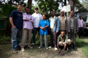
We joined the water supply committee shortly after lunch and asked about the program and the impact it had. We heard stories of how their lives had been changed with access to clean drinking water; how fewer days spent at home with sickness meant that they could spend more time working their fields and producing better crops for their livelihoods, which was great to hear.
At the conclusion of our conversation I asked if they had any plans to expand the water lines to new areas, as that is a place that GIS can have a positive impact. The gentlemen that we were talking to said that they did have plans and I asked them where it was that they wanted to expand to. They described a few locations where they wanted the lines to go to, although as I didn’t know where those places were from their directions, ‘over the hills this direction (pointing) and close to the top of the hill where we extract medicinal plants.’ I didn’t think that I could locate the place that was being described, although a really rich description was being given to me- I just don’t have enough local knowledge and we couldn’t travel to the new locations as they were a distance and it was getting pretty hot in the afternoon sun.
So, instead of being unable to locate the desired water supply points, I thought of a new plan. I knew that I had the local satellite imagery and a few local landmarks loaded into Google Earth in my computer, so with the help of a nearby resource shed, we set up an impromptu participatory GIS session with the water committee members present. I started by giving a guided tour of the place we were located and the surrounding areas alternating from top down to 3D detail to give the committee members an orientation to the map on the computer.
After a few minutes the committee members were pretty comfortable with the map, and discussed with themselves using the same language as before, except this time they navigated through the map at the same time, over the hills in the right direction to the top of the hill that had the medicinal plants*. Within a short period of time we were able to get from a description of the place that I was unable to understand to a precise location of where they wanted, and desired the water supply program to go. (*N.B. that particular piece of information was not reported in the final map to protect the ownership of information. I have also chosen not to publish the data from this project as a result as well)
It was an awesome example how using simple participatory methodologies can really change the nature of conversations and increase our shared knowledge of the land, both in a social and highly scientific nature on the fly, without any pre-arranged setup. It also clearly showed that although GPS based surveys were great for knowing a location with a high degree of certainty, it can sometimes be treacherous (the mountain slope) or inaccessible (far away and during the hottest part of the afternoon) to do so. Participatory GIS clearly won the day, perhaps there is a role for PGIS in other infrastructure developments.
Once finished working with the water project leaders from the community we thanked them for thier time and went on to cover another area of the pipeline infrastructure with the GPS. Late in the afternoon we finished up our activities and headed back to our hotel with fresh sunburns for a well deserved dinner and sleep. In the morning we made the long trek back to Addis starting just before sunrise. It wasn’t the trip that I had planned, but we ended up doing some really interesting work and found a very fascinating fusion between participatory and traditional GPS based data surveys.
Back in Addis, Josh and I had the weekend to enjoy seeing more of the sights of Addis, meeting with a few old friends of mine around town and taking a bit of a break. The next week was the Open Source GIS training that was to be well attended, so I spent a portion of the weekend getting the data ready to be sent back to the field office and making sure that all of my slides were ready to go for Monday morning. It was a great first week for Josh, and over the weekend we were able to get rested and ready for the busy week ahead!
Ethiopia – Week two, part two – (P)PGIS in Enebsie Sar Midir
Ed Note: This post is coming online really late… just completely fell off my radar, somehow. Better late than never!
After finishing the Famine maps on Monday and Tuesday (previous blog), I was eager to get out into the field do to some hands on work with communities. Solomon, who was helping me coordinate my time in Ethiopia, sent me a message Tuesday night letting me know that there was a field program organized for in the Amhara region of the country the next day, in a town called Mertle Mariam in the north of the country. I was happy to hear that I would be working with Agri Service Ethiopia (an implementing partner of Oxfam’s), who I worked with in 2009-2010.
Week two – GIS work for Oxfam Canada (Part One)
My second week in Ethiopia contained a number of different activities. I met with a few organizations on Monday and Tuesday, completed a few maps at the Oxfam Canada office in Addis, and traveled to the north of Ethiopia to conduct a participatory GIS assignment for a project with Oxfam Canada and Agri Service Ethiopia. I’ve decided to break up this week into two parts, so stay tuned for the second half of the week, which will be posted shortly!
Mapping Across Borders in Ethiopia – Week One
After the sights and scenes of France, I made my way on Ethiopia to promote Mapping Across Borders’ services to development institutions, work on various field activities with partner organizations and to conduct a five day GIS training session. To accomplish this work, I would have four weeks – making time short! Over the next few blogs I’ll summarize what I was able to do for Mapping Across Borders in Ethiopia.
Arts, Maps and Society – Paris, France
The third and final conference I attended this summer was in Paris, France in July. Initially I had not planned on attending, but it ended up coinciding with the dates that I wanted to head to Ethiopia and Kenya so I thought it would be a great way to add value to the trip and went.
England conferences
In the last blog, I had just finished a short stay in Germany, where I stayed with a friend of mine who volunteered to be a contact point for Mapping Across Borders and I also attended the Geoinformatik conference at the University of Muenster. This blog continues where it left off, having just landed in London.
European Conferences and Networking
Back in June and July, I traveled to research conferences in Germany, England and France. These conferences were really useful for me to present some of my research internationally, network with new organizations, and to promote Mapping Across Borders to a larger audience. Over the new few blogs I’ll be summing up my adventures and publishing my presentations as well. The first of these adventures was in Mid-June for the Geoinformatic conference.
73 interviews, 29 institutions, 15,000KM, Part II of II
After travelling from St. John’s, Newfoundland to Toronto, I was back in the town I grew up in. It was great to be back, eating home cooked meals and worry free of whether I needed to be packed up and ready to go by checkout time (Thanks Mom and Dad!).
73 interviews, 29 institutions
Since Mid-March, I have been visiting colleges and universities across Canada to both promote Mapping Across Borders to students and professors as well as conduct research interviews for my master’s thesis at UBC Okanagan. Clocking around 15,000km, I visited nine provinces in Canada (nearly all!) and met with many new and old friends.
Mapping Across Borders Website Open!
The Mapping Across Borders website is up and running and we are pretty excited to welcome all blog readers to have a look at it;
The Mapping Across Borders website currently allows visitors a chance to get to know the organization through videos, text, a concept note and an interactive map on the homepage. You can also register from a link on the front page which will allow you to stay in touch with Mapping Across Borders via a mailing list. This way, when Mapping Across Borders is ready to open more services for users, you will be the first to know!
Currently there is still a lot more of the Mapping Across Border’s website to come, but we are steadily working away on it here at UBC Okanagan. This morning we were weeding into database designs and figuring out all of the ways that we want to create intuitive and engaging user interfaces. We hope to have more really cool things to show everyone by September!


